• Biodiversity
    • Why is Biodiversity Important?
    • Threats to Biodiversity
    • What are Species at Risk?
    • Recovery Planning
    • Environmental Monitoring
  • Species at Risk
    • Species at Risk
      • SAR in the Sydenham
      • Mussels
      • Fishes
      • Snakes
      • Turtles
    • Mussels
      • Eastern Pondmussel
      • Fawnsfoot
      • Kidneyshell
      • Lilliput
      • Mapleleaf
      • Northern Riffleshell
      • Purple Wartyback
      • Rainbow
      • Rayed Bean
      • Round Hickorynut
      • Round Pigtoe
      • Salamander Mussel
      • Snuffbox
      • Threehorn Wartyback
      • Wavy-rayed Lampmussel
    • Fishes
      • Blackstripe Topminnow
      • Eastern Sand Darter
      • Grass Pickerel
      • Northern Madtom
      • Northern Sunfish
      • Pugnose Minnow
      • Pugnose Shiner
      • River Darter
      • Silver Lamprey
      • Spotted Sucker
    • Snakes
      • Eastern Foxsnake
      • Eastern Hog-nosed Snake
      • Eastern Milksnake
    • Turtles
      • Blanding’s Turtle
      • Midland Painted Turtle
      • Northern Map Turtle
      • Snapping Turtle
      • Spiny Softshell
  • Stewardship
    • Healthy Watersheds Program
      • Sydenham Phosphorus Reduction Initiative
    • Managing Phosphorus
    • Phosphorus StoryMap
    • Reducing Pollution in Runoff
    • Best Management Practices Resources
  • Stories
  • Get Involved
    • What Can I Do?
    • Take the Stewardship Survey
    • Test Your ID Skills!
    • Report a Turtle Sighting
  • Resources
  • Contact Us
Sydenham River WatershedSydenham River Watershed
  • Biodiversity
    • Why is Biodiversity Important?
    • Threats to Biodiversity
    • What are Species at Risk?
    • Recovery Planning
    • Environmental Monitoring
  • Species at Risk
    • Species at Risk
      • SAR in the Sydenham
      • Mussels
      • Fishes
      • Snakes
      • Turtles
    • Mussels
      • Eastern Pondmussel
      • Fawnsfoot
      • Kidneyshell
      • Lilliput
      • Mapleleaf
      • Northern Riffleshell
      • Purple Wartyback
      • Rainbow
      • Rayed Bean
      • Round Hickorynut
      • Round Pigtoe
      • Salamander Mussel
      • Snuffbox
      • Threehorn Wartyback
      • Wavy-rayed Lampmussel
    • Fishes
      • Blackstripe Topminnow
      • Eastern Sand Darter
      • Grass Pickerel
      • Northern Madtom
      • Northern Sunfish
      • Pugnose Minnow
      • Pugnose Shiner
      • River Darter
      • Silver Lamprey
      • Spotted Sucker
    • Snakes
      • Eastern Foxsnake
      • Eastern Hog-nosed Snake
      • Eastern Milksnake
    • Turtles
      • Blanding’s Turtle
      • Midland Painted Turtle
      • Northern Map Turtle
      • Snapping Turtle
      • Spiny Softshell
  • Stewardship
    • Healthy Watersheds Program
      • Sydenham Phosphorus Reduction Initiative
    • Managing Phosphorus
    • Phosphorus StoryMap
    • Reducing Pollution in Runoff
    • Best Management Practices Resources
  • Stories
  • Get Involved
    • What Can I Do?
    • Take the Stewardship Survey
    • Test Your ID Skills!
    • Report a Turtle Sighting
  • Resources
  • Contact Us

find out why The Sydenham River is A Species-Rich
Biological Treasure
Find out more here! Funding Opportunities
for Farmers!
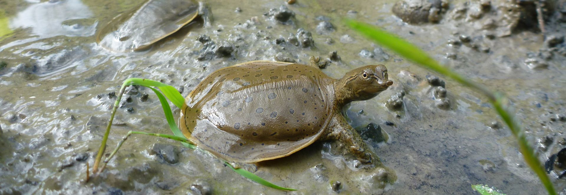
Find out more The Sydenham River is home to the Endangered Spiny
Softshell Turtle
Learn More The Sydenham River is Home to Globally
Rare Mussels
explore Get to know the wonders
of the Sydenham
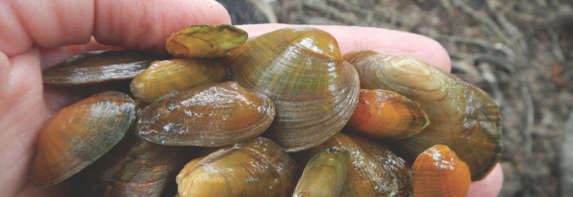
A handful of different freshwater mussel species found in the Sydenham watershed

Stay up-to-date on news, research, events, and more!

2026 Sydenham River Newsletter

2026 Sydenham River Newsletter Spring 2026 | SCRCA Biology Team Check out the 2026 Sydenham…

May 19, 2026Read More

SPRI Newsletter Volume 2 Issue 3: Year 2 Wrapped

Sydenham Phosphorus Reduction Initiative Newsletter Volume 2, Issue 3 | March 2026 | SCRCA Stewardship…

April 14, 2026Read More

SPRI Newsletter Volume 2 Issue 2: A look at Alternative Phosphorus Application

Sydenham Phosphorus Reduction Initiative Newsletter Volume 2, Issue 2 | December 2025 | SCRCA Stewardship…

April 14, 2026Read More

Welcome to the Sydenham

The Sydenham River, known as the Jongquakamik in Nishnaabemwin (Ojibwe), is a biological treasure located in southwestern Ontario. It is the only major watershed that lies completely in the Canadian Carolinian Life Zone and it supports an incredible variety of life, also known as biodiversity. At least 80 species of fish and 34 species of freshwater mussels are found in the Sydenham, making it one of the most species-rich watersheds in all of Canada. More than 20 species of fish, mussels, and reptiles that live in and around the Sydenham River are listed nationally or provincially as Species at Risk and include species of global conservation concern.

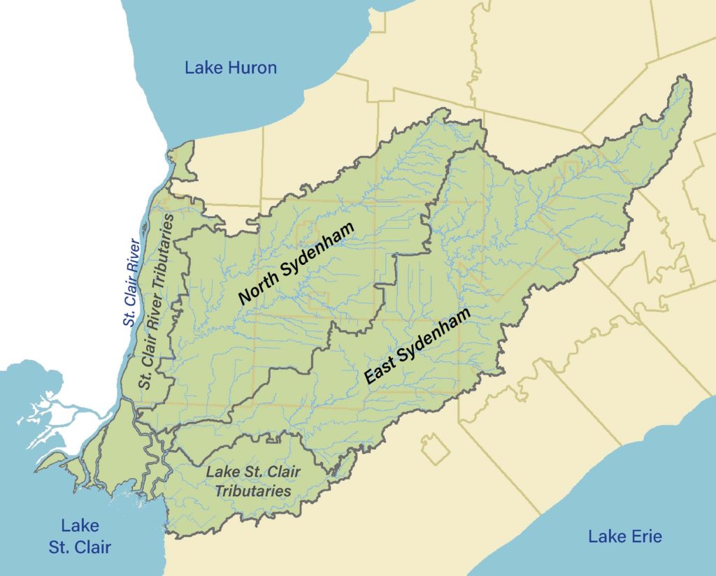
A map of the Sydenham Watershed showing the drainage areas of the two main branches, the North Branch and the East Branch, as well as the St. Clair River Tributaries and Lake St. Clair Tributaries

The Sydenham has two main branches, the North Sydenham and the East Sydenham, which meet in Wallaceburg and outlet to the Chenal Ecarte.

About the Watershed

The Sydenham watershed covers an area of 2,751 km2 and includes portions of the Municipality of Chatham-Kent, Lambton and Middlesex Counties. The watershed is the traditional territory of the Anishinaabeg, Haudenosaunee, Lunaapeewak, and Attawandaron peoples who have longstanding relationships to the land and water of southwestern Ontario.

The river is divided into two main branches – the North and East Sydenham. The two branches meet in Wallaceburg forming the main Sydenham River that flows for 5km before it outlets to the Chenal Ecarte to Lake St. Clair. The Sydenham watershed is in the drainage area for Lake St. Clair and, on a larger scale, is part of the Lake Erie basin.

Picture of the fork in Wallaceburg between the James Street Bridge and Murray Street Bridge where the North Branch and East Branch meet to form the Main Sydenham River.
North Sydenham

Upstream from Wallaceburg, the North Sydenham divides into two tributaries at Wilkesport, Bear Creek and Black Creek. Bear Creek runs further north, passing through Brigden, Petrolia, and Warwick with its headwaters near Arkona. From Wilkesport, the shorter Black Creek crosses by Oil Springs to its source near Inwood.

East Sydenham

The East Branch covers a larger drainage area than the North Branch. Moving upstream from the fork in Wallaceburg, the East Sydenham River travels through Dresden, Florence, Alvinston, and Strathroy with its source waters originating from the Lucan moraine near Ilderton.

Elevation

In general, the watershed is flat with gradual changes in elevation. The elevation of the North and East branches only change by an average of 60-70cm for every kilometer. At the bottom of the watershed near Wallaceburg, the main stem of the Sydenham is even more flat with a slope of only 10cm per kilometer – this lower part of the watershed is low-laying and water levels on the river are impacted by Lake St. Clair and wind conditions.

Geology

The Sydenham watershed is largely covered by silt and clay but the geology in the East Branch has more variety compared to the North Branch as it also has deposits of sand and gravel. The greater diversity in the substrate and therefore available habitats in the East Sydenham translates to greater species diversity.

Picture of riffle habitat in the East Sydenham River

Land Use

The rich soils and relatively warm climate that support the unique plants and wildlife of Canada’s Carolinian Life Zone also support the breadbasket of Ontario. The Sydenham flows through a primarily agricultural landscape, which makes up 85% of the land use.

Many of the watercourses in the watershed are classified as municipal drains which can be natural or constructed but in either case are habitat for plants and animals in the watershed and need to be managed with this in mind. Even intermittent drains that are dry during parts of the year and are only seasonally wet provide spawning habitat for fish.

Picture of a biologist sitting on the bank of a watercourse holding a large northern pike that was collected from a watercourse classified as a municipal drain

Did you know? If you laid all the natural watercourses and municipal drains in the Sydenham watershed end to end, they would stretch from Wallaceburg to Whitehorse!

Compared to other regions in southern Ontario, there is relatively little urban and industrial development along the river itself. Only two communities along the Sydenham have populations of over 10,000 people – Strathroy, located at the upstream end of the East Branch, and Wallaceburg, at the bottom of the watershed. Petrolia is the largest town on the North Branch.

Aerial photo of Dresden showing the town on the East Sydenham River surrounded by farm fields
Why is Biodiversity Important?
Donate to CHRP
Species at Risk in the Sydenham

Glossary

What is Canada’s Carolinian Life Zone? Carolinian Canada, officially known as Ecoregion 7E, is found in southern Ontario with the northernmost edge stretching from approximately Grand Bend to Toronto. The region has the warmest average annual temperatures and longest frost-free season in Ontario. The life zone supports the greatest levels of biodiversity in the province with ecosystems found nowhere else in Canada.


Diagram of a watershed

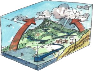
What is a watershed? A watershed is an area of land that captures precipitation that drains to a common waterbody, which could be a wetland, creek, river, lake, or ocean. Watersheds can be considered at different scales from the drainage area of a small pond to the large Great Lakes basin. Everything in a watershed is connected – actions on the land affect conditions in the water.

Check out our latest newsletter! Download

© 2026 · St. Clair Region Conservation Authority - The Sydenham River Watershed

  • Privacy

Press Enter to search · Esc to close

Are you a farmer or rural landowner looking for funding through the Sydenham Phosphorus Reduction Initiative?

Click here to access NEW SPRI funding

Please note: the reduced tillage guidelines have been updated as of April 7, as they were missing key ineligible project costs